2 November 2026 · Forest Survey of India (FSI), Ministry of Environment, Forest and Climate Change · AI-generated
Where India's forests grew, and where they thinned
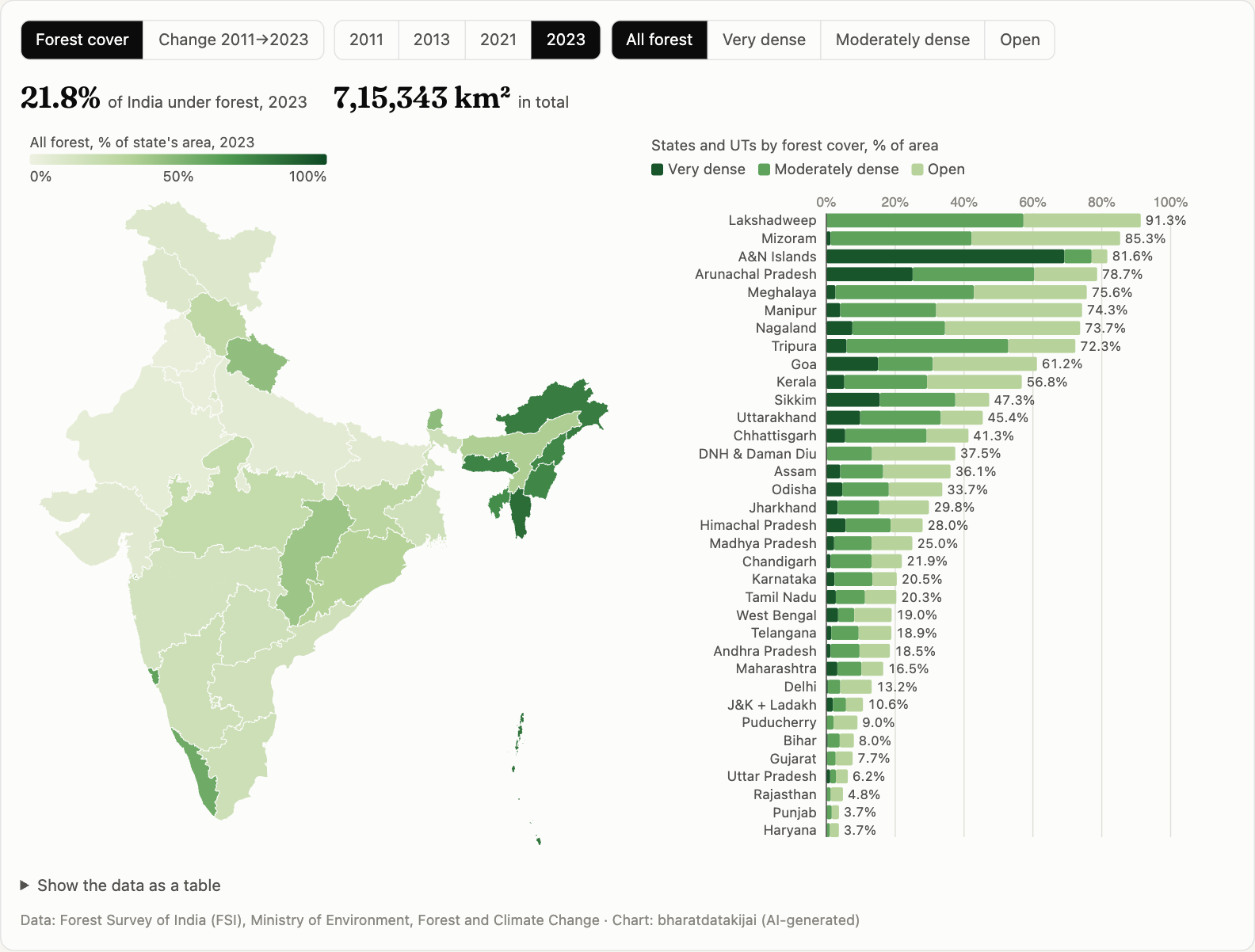
India's forest cover grew by 23,316 km² between 2011 and 2023. Six north-eastern states, among the greenest in the country, lost a combined 4,955 km².
Data: Forest Survey of India (FSI), Ministry of Environment, Forest and Climate Change · Chart: bharatdatakijai (AI-generated)
Every two years the Forest Survey of India maps the whole country from satellite images and counts any hectare where tree canopy covers at least 10% of the ground. In 2011 that came to 692,027 km², or 21.05% of India. In 2023 it was 715,343 km² (21.76%).
Most of that gain is in open forest (+17,347 km²) and very dense forest (+19,031 km²). Moderately dense forest shrank by 13,063 km². The biggest gains were in Andhra Pradesh and Telangana (+4,875 km²), Kerala (+4,759 km²), West Bengal and Odisha.
The north-east tells another story. Arunachal Pradesh, Mizoram, Nagaland, Manipur, Tripura and Meghalaya lost 4,955 km² of forest between them. Nagaland went from 80.3% forest to 73.7%, the biggest drop of any state. Mizoram went from 90.7% to 85.3%, though it’s still India’s most forested state.
Read the change with care. “Forest cover” here includes plantations and orchards. FSI’s methods and imagery also get better with each report, so some of the change between reports is a change in measurement. Switch the density class to see which kind of forest moved, and hover over a state for its numbers in all four assessments.